Archive | weather RSS feed for this section

Backpacking and Photography in the Petrified Forest National Park

13 Jun

Exploring the Painted Desert and Black Forest areas of the Petrified Forest National Park

07197627-rock-crawl---Copy-2

“The Wanderers” Early morning dappled light in a remote area of the Petrified Forest

The Petrified Forest National Park lies along the remote eastern border of Arizona near the small railroad town of Holbrook. Surrounded by the Hopi, Navajo and Zuni Indian Reservations, vast rolling badlands feature copious amounts of petrified wood. A paved road connects two visitor centers. The drive between features various landmarks, overlooks, pueblos, mesas and other Route 66 curiosities.

The park closes at sunset and does not have a campground. The only way to spend the night is by backpacking. Entrance fees are $20 and backcountry permits are free. Of course, bring plenty of water!

Timing your visit to this arid high-desert playground is tricky. Expect 40-degree differences between highs and lows. There are no perfect months for weather. Late spring and early fall are top choices for comfortable days and chilly nights.

The mission of my June 1st visit  to successfully capture the full moon. We choose to enter the backcountry from the unnamed trail near the Painted Desert Inn (historic landmark) in the northern sector. There are no topographic maps available at the visitor center and a GPS is highly recommended.

After setting up camp, I settled upon a rocky perch ringed with various geologic oddities overlooking crimson badlands for the sunset session. Light was harsh and a 400 mm lens would have been useful. Photography was tricky especially finding suitable foreground compositions and capturing adequate depth of field.

07197546-hoodoos-sunset-painted-desert-flat---Copy
“Extraterrestrial Flapjacks”


As the light waned I was almost to busy pursuing my goal of the perfect shot to notice the absence of the full moon. The sky was ninety-percent clear but obviously it was hiding somewhere. I could not even see a source of light! As I packed up my belongings writing off another opportunity to capture one of my favorite subjects…the moon peeked out behind the veil of thick clouds. I worked quickly to capture the scene and to my delight to develop an adequate rendition of my experience.

07197572-moon-fortress-flat-2---Copy

“Lunar Fortress”

As the night progressed the clouds thickened and when I awoke I knew that it would be a fantastic sunrise.  The color appeared quicker than anticipated as I scrambled up a steep, clay mesa behind our campsite near a wash. While I had not scouted this spot the night before, I was pleased with the unending views as well the abundant petrified logs.

Sunrise-painted-desert-flat---Copy

“Primordial Firewood”

While I expected the sky to clear, a fresh new layer of clouds flew into the scenery. I climbed higher above the badlands for a bird’s eye before settling on a distant location. I predetermined a safe way down and knew that I’d have just enough to time to capture the best light.

07197610-best-morning-light-painted-desert---Copy

“Solitary Awakening”

While the day heated up we ventured out for one last round of sight seeing before returning to our vehicle. The desert smelled of rain and distant storm clouds confirmed our senses. I had difficulty finding the location I had visited earlier but stumbled upon miles of other enticing scenic interests. I’d love to learn about your favorite interpretation of my experiences. Thanks for reading and sharing!
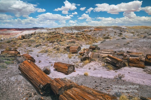
07197718-Petrified-Last---Copy

“Day of the Sky”

07197723-Edit-the-long-wood---Copy

“The Long Wood”

5 Tips for a Better Backpacking Trip

6 Oct

For many October represents the last month for backpacking without traveling. Here in the Southwest, it is the beginning of the backpacking season. Whether you live close to the mountains, forest, ocean or desert, these are five tried-and-true backpacking tips to help you get more out of your next adventure.

07191520-Dollar-Sunrise-Align

Off-trail backpacking in the Weminuche Wilderness

  1. Pack Smarter – One way to maximize your travel load is to pack items that have more than one use.  For instance, mix olive oil in hot food for extra calories and  use it as a nighttime facial moisturizer. Likewise, a trowel is primarily used to dig latrines but can also come in handy in emergency situations. Carefully selecting multifaceted items helps keep pack loads lighter because you can do more with less. Traveling lighter also makes hiking more enjoyable.
  2. Invest in a Better Sleeping Pad – It’s amazing how many people still carry the old-school foam sleeping pads. While ultralight, inflatable sleeping pads are more expensive, it’s a worthwhile investment. Not only will you sleep better but you’ll be warmer as high-end inflatable pads are insulated and keep you off the ground. Improving your sleep quality in the backcountry means a more enjoyable experience and you’ll think more clearly too.
  3. Count Calories – Packing the right amount of food is an art and taking the time to stay organized pays back dividends. How much is too much? To save money, starting purchasing food several weeks before and stockpile. Visit a variety of grocery stores to get the best deals. Once your cache is complete, divide the food into days by meticulously counting  calories per package labels. Two-thousand calories per day is sufficient. Store in bags and label each day. Bonus tip: consume your heaviest and bulkiest items first. If buying dehydrated meals like Backpacker’s Pantry – buy in bulk to save money. These meals last for years.
  4. Cut Labels and Packaging – The majority of cutting will be performed on food packaging. Cut the ends without compromising freshness. If the original packaging is too bulky (usually bags) repackage altogether (except for jerky). Also be sure to cut the labels off of your tent, sleeping bag, and clothes. Labels and packaging add up. You could save between 12 – 15 ounces easy.
  5. Mental Preparation – I am huge proponent of mental preparation. Study the weather reports and comb over topographic maps. Make sure you know the elevation and distances for each leg of the trip. Identify an areas on your hike where the trail could be faint or a creek crossing difficult. If finding water is an issue, this is where you need to plan accordingly. Most adventures hold surprises and mental preparation could be the difference between having fun or making a serious blunder.
07191731-HDR-above-quartz-flat---Copy-2

Taking in a backcountry sunset in the South San Juan Wilderness

Arizona’s Top 3 National Monuments Part 2

7 Jul

125030461_orig

Arizona is brimming with enchanting places to explore including over a dozen national monuments. This is the second of a three part series on my favorites, including the pros and cons, best times to visit, and other key travel tips.

Organ Pipe Cactus National Monument

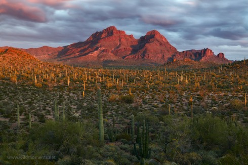
A long, winding dirt road pierces the desert floor leading toward a crest of crimson cliffs. While speckles of jubilant yellow dot the hillsides, this is a foreboding place. Chiseled by arroyos and protected by chollas, views fan out beyond the unseen international border. Despite the crusty terrain, the ride is smooth and the warm, dry air is surprisingly fresh.

By mile four, undulating gardens of distinctive cacti animate the landscape. In the fading light of day, these haunting figurines mimic the human form. Normally, the patriarchal saguaro rules the Sonoran but in this lonely pocket of country features a rival. The banana-shaped organ pipe cactus is not as tall as the saguaro but much wider. While common in Mexico, organ pipe are only found in this US park, which is also a UNESCO biosphere reserve.

jurassic-park

At nearly 331,000 acres Organ Pipe Cactus NM is the largest national monument in AZ with 95% of the land designated wilderness. Park visitors can explore via two scenic loop drives. The Ajo Mountain drive is the most popular and scenic. It is a 21-mile, one-way loop that traces the base of the mountains before circling back toward the visitor center. Across the highway is the Puerto Blanco Loop, a 37-mile drive through mostly open desert and gaping views. Other rough 4WD roads are options for longer stays and seasoned visitors.

The park has several official hiking trails but the premier trek is summiting 4808-foot Mount Ajo, the areas highest peak.  This is a full-day hike, partially off-trail totaling 9 miles with a cumulative elevation gain of 2800 feet. Definitely not for beginners. A shorter and easier option is hiking the trail from the campground to the visitor center. Enjoy pleasant views of the mountains while traversing through copious cholla gardens. There are a few benches along the way.

empire-2

The exceptional Twin Peaks Campground, featuring 360-degree views, was fully remodeled less than ten years ago. There is reliable vacancy nearly year round. If interested in hotels, find a few in the town of Ajo about 35 miles away.

Summers at Organ Pipe Cactus NM are hot. The ideal times to visit are between November and early April with pleasant daytime highs and cool nights. Delicate ground flowers such as poppies and owl clover flourish in late February and early March. The strength of annual blooms vary and flowers wither when daytime highs exceed 85 degrees. Saguaros and organ pipe cacti don’t bloom until May.

Dining choices are also limited. There is a convenience store and small diner in Lukeville, a military-border town about seven miles away. Purchase a few snacks and cold water at the visitor center, otherwise, it’s a lengthy drive to a restaurant.

cloudy-day

If you are interested in seeing the best of Organ Pipe Cactus NM consider joining me on a group workshop. Due to high springtime demand of my private tours,  I’m assembling a 3-day group event in March of 2018. If interested, message me for more information.


Leaving for Frozen Yellowstone This Week

16 Jan

I am preparing for my first photography trip of 2012 to  Yellowstone National Park. Later this week, I’ll arrive in Bozeman, MT  where I’ll spend nearly a week exploring the frozen tundra of Yellowstone in search of interesting landscapes and wild animals. While I have spent some time in Yellowstone during a snowstorm, it was during the fall and not the frozen heart of winter.

My experience in dealing with sub-freezing temperatures is limited and I am not exactly sure what to expect. Considering that I have lived in Arizona for the past 16 years , I am not used to hardcore winter photography where temperatures can drop below zero.

Just minutes before a huge snowstorm hit Yellowstone Lake

Just minutes before a huge snowstorm hit Yellowstone Lake, captured in early October

Because I’ll be assisting another photographer in leading a large group – I don’t exactly have the autonomy I normally do on a photography excursion by myself.  However, I am still hoping to come away with some quality images. Currently, the weather forecast looks like snow, snow and more snow so I am not sure how that is going to translate into landscape images, which I favor over wildlife scenes.  My goal is to push the bounds of my creativity and hopefully come up with something unique, especially if the light is less than spectacular.

Any suggestions or tips for dealing with the cold weather are greatly appreciated. I have hand and feet warmers, but I am still not sure how equipped or prepared I am in dealing with the frigid temperatures.

Back from Snowy Colorado Part 1

18 Oct

We returned safely from our adventure in Colorado last week and I wanted to share some pictures and conditions from our first couple of days on the road. We departed Phoenix around 4:30am PST and made it to Cortez by about 1pm MST. From Cortez, we headed up the 145 touring the picturesque Delores River Valley toward Lizard Head Pass, seeing the first signs of snow approximately five miles outside of the town of Delores and before Rico.

The first storm of season had hit the area the day before and blanketed the mountain slopes with up to a foot of snow. The weather was a mix of partly sunny conditions with fast-moving clouds with temperatures in the low 40’s.  The trees in that area were a mix of peak, past peak, and still green – a theme that became the dominant foliage conditions of the trip.

What’s interesting, is as we drove towards the Dallas Divide there were large areas of the mountains that didn’t appear to have any snow or that it had already melted. A few token stops along the way didn’t yield any keepers and we settled into our hotel in Ouray, stopping for happy hour at O’Brien’s Pub in the downtown area. By nightfall, the cloud cover was getting thicker and it was obvious another storm was moving in. The snow started a short time later…

We overslept a bit the next morning for sunrise as I set my alarm on my Blackberry for the right time, but the phone never changed time zones like the rest of us. Luckily, we still woke up in time. When I went outside to heat up my ride, it was still snowing and there was a fresh three inches of powder covering my SUV.  We made our way towards the Dallas Divide on snow-covered roads.  The snow did stop a short time later but the skies did not clear in the right place to catch any sunrise color. Still, it was a beautiful morning and I was able to capture this image about 45 minutes after sunrise.After spending the first part of the morning on County Road 7 we headed back towards Ridgway to check out Owl Creek Pass. It didn’t take long for that road to turn to snow too and we found ourselves four wheeling in what was easily six inches of fresh snow.  As we made our way up and over the 10,114 foot Owl Creek Pass towards Silver Jack Reservoir, I stopped to capture this image taken close to 11:00 am.  There was definitely a foot of snow on the ground where I was standing…The temperatures were in the mid 40’s by the time we stopped for lunch near the Silver Jack Reservoir. This was our first time in the area and I was quite impressed with the dispersed camping opportunities as well as the side roads and hikes to explore the area. The views were 360 degrees and the foliage was looking great, good, past peak, and not yet changed all at the same time again.  Here is an image of the main road between Owl Creek Pass and Silver Jack Reservoir. As you can probably tell by the previous two pictures the weather was partly sunny, but that didn’t last long as heavy clouds were moving in.  I captured this next image just a short way down the road….This was pretty much our turning around point as had about a 75 minute commute back to Ouray and the weather was threatening again. On the way back, much of the snow had melted on the road and there were many more people out and about.  This was our last stop of the day, one of the more iconic foliage view points in the area located just inside the Uncompahgre National Forest boundary. I have several more days of pictures and reports to share with you, and I hope you enjoyed this one as well as the pictures. If you have a particular favorite or favorites, I would love to know about it. Thanks so much for reading.

Leaving tomorrow for snowy Colorado

6 Oct

Tomorrow marks the start of my second annual visit to Colorado for autumn foliage. Last year, we visited the week earlier, stayed in lovely town of  Telluride,  and the timing was perfect for color. The weather was generally cooperative with a few minor afternoon storms and some overnight snows coating the high peaks of the San Juan Mountains.

This year appears a totally different story.  As I write this, a massive storm is pounding much of the state with up to a foot of snow.  It’s effects can be felt all the way to Phoenix, where temperatures have significantly dropped and the winds have picked up big time. Originally, the plan was to camp most nights and stay in a hotel to get a good night’s rest and get cleaned up before we return home, that’s now changed.

This year, we designated Ouray as our base camp. For those of you not familiar with the area, Ouray is the northern most town located on the San Juan Scenic Loop and is about an hour drive from Telluride and probably closer to two hours from Durango.  Getting there could be the biggest problem as the mountain passes are snowy, wet, and treacherous. By the time we reach the area tomorrow the worst of the storm should have passed, but forecasts are calling for lingering snow showers possibly as late as Sunday.

Driving the region’s back country roads can sometimes be a daunting task, but when wet and muddy obviously it can get extremely dangerous. There’s also the possibility the high winds would eradicate what’s left of the region’s foliage, which could significantly decrease photo opportunities.  The storm also brings plenty of promise as well. The mountains will look incredible and snow-covered foliage is a wonderous sight.  The weather should improve over our last couple of days in the region and conditions could be optimum for landscape photography.  It’s hard to tell what this trip will bring, my primary goal is to make it home safely, hopefully will a handful of really good photographs to share with you.